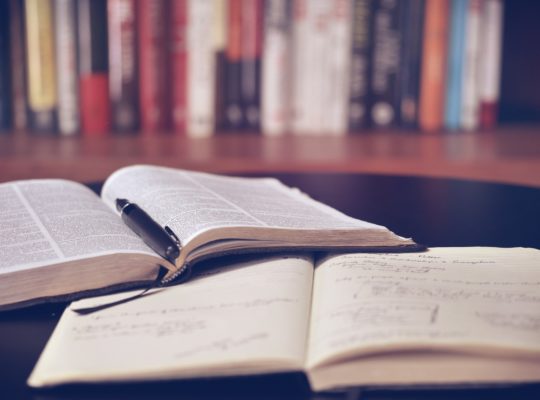
LIBRO DE RUTA
24 de JUNIO-2 de JULIO 2006 ISLANDIA
Llovía cuando aterricé en el aeropuerto de Keflavík na noche de finales de junio. Llovía con fuerza y soplaba un viento huracanado que zarandeaba de tal modo el avión que, incluso cuando se detuvo junto a la terminal, observé entre los pasajeros cruces telegráficos de miradas cargadas de desconfianza. Lo primero que vi por la ventanilla fue a un hombre equipado con un llamativo uniforme color naranja que avanzaba por la pista luchando abiertamente contra el viento: inclinado hacia delante las piernas separadas, la ropa hinchada y la cabeza gacha. Se movía con tanta torpeza que parecía un astronauta caminando por la Luna o un explorador en el Polo norte. Al fondo, entre jirones de niebla, se intuía una cadena de montañas negruzcas; del otro lado se extendía un mar hostil, de un antipático color gris metálico, con olas de consistencia marmórea que morían en una desoída playa volcánica. Con aquella imagen me bastó para comprender que la naturaleza es la gran protagonista en islandia y, a juzgar por lo que estaba viendo, no se trataba de una naturaleza amable, a escala humana, sino de una naturaleza dispuesta a mostrar y a ejercer todo su poder.
La isla secreta. Un recorrido por Islandia. Premio Grandes viajeros 2002. Xavier Moret
SABADO 24 SALIDA 23:35. SALIDA DESDE EL SATELITE DE LA T4
LOCALIZADOR: ZI9C8V
TRAYECTOS:
Vuelo de BRITISH AIRWAYS, número BA2471
Salida: Sábado 24 de Junio de 2006, 23:35 hs. desde MADRID,SPAIN (MAD)
Terminal: 4S
A LONDON,UNITED KINGDOM (LGW) a las 00:45 hs.
Estado del vuelo: Confirmado
Vuelo de BRITISH AIRWAYS, número BA2790?
Salida: Domingo 25 de Junio de 2006, 07:30 hs. desde LONDON,UNITED KINGDOM (LGW)
Terminal: N
A KEFLAVIK,ICELAND (KEF) a las 09:45 hs.
Estado del vuelo: Confirmado
1º DIA. DOMINGO 25 VISITA REYKIAVIK
DOMINGO NOCHE EN LANGARVAH
Laugarvatn – Reykjavík
· Coming from Laugarvatn take road no. 37 and 35 until you reach road no. 1.
Travel on road no. 1 over the mountain plateau Hellisheiði to Reykjavík.
Location: Laugarvatn is situated on road no. 37 appr. 50 km. from road no 1.
Laugarvatn
Dalsel
Laugarvatn
840
Iceland
Tel. 354-4861215 / 8995409
Fax. 354-4861215
laugarvatn@hostel.is
Hostel Details
Laugarvatn is a village with 300 inhabitants and is located midway between Þingvellir, Gullfoss and Geysir, 100 km from Reykjavík. Just outside the Hostel there is a hot tub available for the guests. Within a 500 meters walking distance from the Hostel you will find the only natural sauna in Iceland, along with an outdoor swimmingpool, post office, bank, a grocery shop and a restaurant. There are possibilities to hire a boat or a sailboard to use at lake Laugarvatn. Nearby you will find a lot of marked hiking routes. Just outside Laugarvatn there is a golf course and the possibilities of angling in waters and rivers in the area. The hostel has a 4×4 wheel Econoliner to take tourist on trips. Ask at the hostel for more information. Next Hostels: Árnes, 57 km – Hamar, 160 km.
Walking distance to the only natural sauna in Iceland.
Attractions Historical sites nearby
River/harbour/lake nearby
Hiking area
Main attractions nearby
Swimming pool at or near hostel
Restaurants nearby
Shopping centre/market nearby
Facilities Family rooms available
Sheets for hire
TV room
Self-catering kitchen
Groups welcome
Common room(s)
Sauna
Laundry facilities
Café/Bar
Individual traveller welcome
Luggage Store
Non smoking room/area
Garden
Green Hostel
Cycle store at Hostel
2º Día.LUNES 26 VISITA PINGVELLIR / GULLFOSS / GEYSIR / ARNÉS
PINGVELLIR:
Parque natural localizado en el sudoeste del país donde confluyen las dos principales placas tectónicas de la tierra, la americana y la europea. Allí se encuentra también el lago más grande de Islandia, del que fluye el río Öxará. En el ámbito histórico, este parque natural es conocido ya que aquí se creo el primer parlamento del mundo, en el siglo X, cuando todos los campesinos del país se encontraron y decidieron establecer leyes y regulaciones, para así poner fin a sus desacuerdos con leyes en vez de luchas armadas.
· Most important place in Icelandic history.
· Situated on the banks of the lake Þingvallavatn, the largest lake in Iceland (84 km2).
· The old Icelandic parliament (Alþingi) was founded here in the year 930.
· It was the biggest annual event for Icelandic farmers. They came together for two weeks every summer to meet each other and to follow the parliament sessions.
· At this site Icelanders voted to become Christians in the year 1000.
· Since 1928 the area is a National Park.
· Þingvellir is a large lava field, situated right on the Mid-Atlantic Ridge, where the European and North American plates are moving apart.
· Service station and tourist information during summer.
· Excellent multimedia-exhibition on geology and history near the view point above Almannagjá.
GEYSIR:
Geysir es la zona geotérmica que hizo creer a los vikingos que bajo la isla se encontraba el infierno. Se accede por un camino marcado, alrededor del cual brotan chorros de agua y fumarolas de todos los tamaños y formas. El autentico Geysir que alcanzaba los 80 metros de altura, está inactivo desde hace tiempo. A pocos metros se encuentra el Strokkur, un géiser de casi 20 metros de altura que surge cada 15 minutos.
· Hot spring and mud spring area in the valley Haukadalur, named after the famous hot spring Geysir.
· Eruptions of Geysir itself are unpredictable, but the hot spring Strokkur erupts every 5 to 10 minutes.
· Hotel, restaurant, cafeteria and gas service station.
· Interesting geological multi-media exhibition called Geysistofa.
GULLFOSS:
En islandés, “gull” significa oro y “foss”, cascada. La “cascada de oro”, la más grande de Europa es una impresionante caída de 50 metros sobre el río Hvitá. Este río glacial se precipita por el borde de una falla cayendo en un profundísimo cañón, formando un vistoso arco iris y levantando una gran cantidad de espuma
· Famous and impressive waterfall on the river Hvítá.
· The name means the Golden Waterfall.
· The water falls into a gorge which is 70 m deep.
· The waterfall itself is 32 m high and 250 m wide.
· Information and service center, with an exhibition area called Sigríðarstofa.
· After visiting Gullfoss, take road no. 30 to Flúðir.
· If you want to stay at Árnes Hostel turn left onto road no. 32 and continue on this road until you reach Árnes.
· Information on Árnes Hostel and surroundings especially Þjórsárdalur see website.
· If you want to stay at Fljótsdalur Hostel continue on road no. 30 until you get on road no. 1, turn left onto road no. 1 to reach Hvolsvöllur, after leaving Hvolsvöllur behind turn onto road no. 261 to get to Fljótsdalur.
· Information on Fljótsdalur Hostel and surroundings see website.
A classic excursion to many of the scenic natural wonders for which Iceland is justly renowned. First over a part of the highland plateau to Hveragerði where harnessed geothermal power has permitted a greenhouse industry with fruit, vegetables and exotic plants flourishing under glass.
Then to the picturesque Kerið, a lake-filled extinct volcanic crater, before continuing to Skálholt with its new cathedral, the site of an ancient bishopric, and for centuries Iceland’s main cultural center. Onwards to mighty Gullfoss (the Golden Waterfall), perhaps the most beautiful in the country. After our lunch stop we’ll explore the world-famous, fascinating Geysir area, where hot springs and other geothermal phenomena abound, and with the very active geysir Strokkur spouting every few minutes.
On we go under scenic mountains, past the summer resort Laugarvatn, and over a highland moor to descend into the rift-valley which is the boundary between tectonic continental plates and the site of the Þingvellir National Park. This splendidly scenic place is of tremendous geological and historic interest. For centuries it was the site of the oldest democratic parliament in the world, founded here in 930 A.D. and still active. Homeward bound, the tour goes over the Mosfellsheiði heath and to Reykjavík.
LUNES 26 NOCHE EN ARNÉS
Arnes
Gnúpverjahreppur,
Selfoss
801
Iceland
Tel. 354-4866048 / 8612645
Fax. 354-4866044
arnes@hostel.is
Location: Árnes is located about 22 km from road no. 1. To visit Árnes you take road no. 30, east of Selfoss and then road no. 32, appr.14 km from road no. 1.
Attractions Hiking area
Swimming pool at or near hostel
Horseriding at or near hostel
Restaurants nearby
Shopping centre/market nearby
Facilities Family rooms available
Hostel open 24h
Sheets for hire
TV room
Self-catering kitchen
Groups welcome
Common room(s)
Credit card accepted
Café/Bar
Meals available
Individual traveller welcome
Luggage Store
Non smoking room/area
Garden
Playground
Cycle store at Hostel
Hostel Details
Árnes is conveniently located close to all major tourist attractions in the South of Iceland, appr. 90 km from Reykjavík. Next door to the Hostel there is a swimming pool with a hot pot and a licenced restaurant, which provides lunch and dinner for individuals and groups. In the area around the Hostel there are good hiking trails. Appr. 30 km. from Árnes is Þjórsárdalur. Valley of the river Þjórsá through which three other rivers flow as well, a landscape of sharp contrasts such as flourishing birch woods, sandy lava fields, rivers and waterfalls. Gjáin is a stunning ravine with lush vegetation, numerous springs, bizarre rock formations and a pictureseque little waterfall, Gjárfoss. Other remarkable waterfalls in the valley are Hjálparfoss and Háifoss. A flourishing farming community lived in þjórsárdalur after the settlement until the valley was swamped by ash from an eruption from Mt. Hekla in 1104. One of the ruined farms, Stöng, has been excavated and served as the model for the nearby Saga-Age farm reconstruction (Þjóðveldisbærinn). Next Hostels: Laugarvatn, 56 km and Fljótsdalur, 50 km.
3º DIA MARTES 27 ARNÉS/LANDMANNALAUGAR
Distances: Árnes-Þjóðveldisbær 20 km, Þjóðveldisbær-Hrauneyjar 49 km, Hrauneyjar-Landmannalaugar 25 km, total: 104 km).
Con un autobús: Hay viajes diarios a Landmannalaugar de Reykjavík a partir del medio de junio al medio de septiembre. Salida de BSÍ (estación universal central) en 8:30. El precio es casi 5.000 IKR. Hay también viajes diarios de Skaftafell. Los autobuses se paran durante 2 horas en Landmannalaugar y permiso a Reykjavík y Skaftafell en 14:30. A mediados de verano hay viajes sceduled de autobús entre Landmannalaugar y M ý vatn. Las reservas no son necesarias.
Informaciones por Austurlei ð-Kynnisfer ð ir
teléfono 545 1717.
Conducción de un coche: Usted puede tomar su propio coche a Islandia con el barco o alquilar un coche en Islandia. Los seguros no pagan por coches de alquiler dañados sobre caminos de F (caminos de montaña). Hay tres carreteras generales(calles mayores) que conducen a Landmannalaugar. El más fácil es la F 208 del norte, de las centrales eléctricas. No hay ningunos ríos para cruzarse, entonces un coche normal será bastante, pero estar preparado para alguna sacudida. Usted necesita coches más grandes, con 4Wd para otros caminos. Segundo más fácil es la F 225 del oeste (cerca de mt. Hekla) y tercer más fácil es la F 208 del sur (entre Vík y Kirkjub æ jarklaustur). Infórmese sobre el tiempo porque el agua en los ríos puede diferenciarse mucho.
Where you can sleep
Camping : In the nature reserve area, you may only camp at Landmannalaugar, Landmannahellir and Hrafntinnusker. Outside the area you may camp anywhere where you don´t spoil anything. There are camping fasilities where there are huts and there you have to pay something.
Huts and houses :
NB We, the shop owners, are NOT selling accommodations, neither for campers nor hut sleepers.
Landmannalaugar and the other huts at the Laugavegur-trail .
Tel: 568 2533.
One night in the hut for one adult costs 2.200 IKR. It is necessary to order few months in advance if you are going to stay in the high touristic season.
Ferðafélag Íslands – FÍ. www.fi.is
A good advance is also recommended for the other accommodations:
Landmannahellir – four huts, 20 km. from Landmannalaugar. A small river to cross. Tel: 853 8407 and 893 8407
Hrauneyjar – highland center and motel, 40 km. from Landmannalaugar. No rivers to cross. Tel: 487 7782
Áfangagil – small hut, around 50 km. from Landmannalaugar. Rivers to cross.
It still lies aside the main touristic roads (later on it will be a part of a prolonged Laugavegur). Áfangar: 845 9500.
Hólaskjól – three huts, 38 km. from Landmannalaugar. Rivers to cross.
Tel: 854 9977 and 894 9977
Hólaskógur – big hut, around 60 km. from Landmannalaugar. No rivers to cross.
Tel: 820 8784
Bombonas de gas
The grey Coleman cartridges are usually available. The bigger screwed type exists in two variations, which look almost the same, but your cooking equipment maybe fits to just one of them (too short needle). More information about GAS.
It is hard to get purified benzin for a cooker withour having to buy 5 liters at once.
Red spiritus is more easy to get, but it is only in one liter bottles. That you will get in Landmannalaugar and we shall try to have the benzin as well.
Maps
The National Land Survey of Iceland (Landmælingar Íslands) made a special map for the area around and between Landmannalaugar and Þórsmörk. The Laugavegur trail is marked on it. The scale is 1:100.000. We sell it for 1.000 IKR
They also made maps in scale 1:50.000 but they cover small area each. The one with Landmannalaugar (1812 I) is sold out in the country.
Tiendas
En Landmannalaugar tenemos la única verdadera tienda en las tierras altas del sur.
Planificamos abrir alrededor el 20 de junio en 2006 si los caminos estarán abiertos para entonces.
Usted también puede comprar algo para comer en Hrauneyjar y en Þ órsm ö rk, si usted lo pide.
En Hrauneyjar, de otra parte, hay un quiosco, un restaurante y una estación de gasolina.
Usted no puede comprar el alimento de combustible y caliente por nosotros.
Nuestras horas de apertura son de 11:30 a 20:00 diariamente(a diario) a partir de finales de junio a 31. Agosto.
MARTES 27 NOCHE EN LANDMANNALAUGAR
4º DIA MIÉRCOLES 28 LANDMANNALAUGAR/HVOLL
Exploración de la vasta grieta volcánica y de las cascadas de Eldgjá y Ofaerufoss grácias a un senderismo de 1 a 2 horas. Dirección al este se admiran las cuencas de Skeidarársandur, formadas por la erosión de los glaciares.
MIÉRCOLES 28 NOCHE EN HVOLL
Location:The Hostel is located appr. 24 km east of Kirkjubæjarklaustur and 45 km west of Skaftafell National Park, appr. 2,5 km from road no 1.
Landmannalaguar- Road nº1(73 Km)-Rd nº 1-Hvoll (45 Km)
HvollSkatárhreppur,Klaustur880Iceland Tel. 354-4874785 / 4874784Fax. 354-487890hvoll@hostel.is
Hostel Details
The Hostel is in a new building and is ideally located for those who want to do hiking tours in the National park in Skaftafell, visit Jökulsárlón, go to Laka or Landmannalaugur. In the surroundings of the hostel you can find many species of birds and hiking trails. The guestkitchen at the hostel is very well equipped. Next Hostels: Vík, 95 km – Vagnsstaðir, 110 km.
Great starting point for hiking tours.
Attractions Hiking area
Forested/wooded area
Mountainous/hilly area
Facilities Family rooms available
Suitable for wheelchair users
Sheets for hire
TV room
Self-catering kitchen
Groups welcome
Common room(s)
Laundry facilities
Credit card accepted
Individual traveller welcome
Luggage Store
Lockers available
Garden
BBQ
5º DIA JUEVES 29: VISITA PARQUE NACIONAL DE SKAFTAFELL:
· Former westernmost farm of the Öræfi district built high on the southern slopes of the moor Skaftafellsheiði.
· It is situated in a sheltered sunny position and has therfore the benefit of a superb microclimate.
· Today the center of Skaftafell National Park.
· Includes such diverse landscapes as ice sheet, glaciers, tumbling glacial rivers, waterfalls, rich vegetation and moorland.
· Variety of hiking trails and walking paths.
· Especially interesting: hiking trail to Skaftafellsjökull glacier and to the waterfall Svartifoss, several view points.
Information center, exhibitions, cafeteria
Situado en el sudeste de Islandia y en una de las lenguas del gran glaciar Vatnajökull, este parque combina el verde de sus arboladas laderas con el gris oscuro de sus arenales de origen volcánico y la blancura del glaciar dominado por el pico Hvannadalshnjúkur de 2119 metros de altura. cascada de Svartifoss
Glacier trips
Nobody should set off on a trip onto a glacier without mountaineering experience and the necessary equipment. Organised tours with experienced mountain guides are the safest option.
Ice on glacier tongues can be extremely slippery. Walking on glacier tongues is dangerous without crampons and other glacier-climbing gear. The ice caves and vertical glacier walls of glacier tongues
are unsteady, and blocks of ice can fall without warning. Therefore, it is inadvisable to enter ice caves or to stand near steep walls of ice.
When walking on snow-covered glaciers, it is necessary to use a rope and other safety equipment, as crevasses lurk under the cover of snow in many places. The crevasses can be very deep and wide.
Blue Ice Experience
Level easy; 2 hrs. walk on crampons.
Walk on the Svínafellsjökull glacier tongue, through a wonderland of icy sculptures, ridges and deep crevasses. We teach you how to use basic glacier equipment like crampons and ice axes.
Departure from:
the IMG base camp in Skaftafell National Park
Glacier walk 2 1/2 hrs.
Included: Guiding, glacier gear and safety equipment.
Note: Bring warm clothing, raingear and hiking boots
Glacier Adventure
Level moderate; 4½ hrs. hike and scrambling on ice with crampons
Climb the Svínafellsjökull glacier tongue up to its deep valley between the summits of Hvannadalshnúkur and Hrútsfjall, traversing zones of different glacial formations. Discover huge water cauldrons, deep crevasses and strangely shaped ridges.
Departure from:
The IMG base camp in Skaftafell National Park
Glacier Adventure
Included: Guiding, glacier gear and safety equipment.
Note: Bring warm clothing, raingear, hiking boots and energy bars.
Base price: 5.400 ISK
Do not hesitate to contact us for further information regarding our tours and our company.
Icelandic Mountainguides
Vagnhöfði 7
110 Reykjavik
Iceland
Tel: +354 587 9999
E-mail: mountainguide@mountainguide.is
JUEVES 29 NOCHE EN HVOLL (HVOLL-JOKULSARLON 127 Km)
6º DIA VIERNES 30: VISITA LAGO GLACIAR DE JÓKULSÁRLON/SKOGAR (230 Km)
Jökulsárlón-Skaftafell 57 km, Skaftafell-Hvoll 48 km, Hvoll-Kirkjubæjarklaustur 24 km, Kirkjubæjarklaustur-Vík 71 km, Vík-Skógar 32 km).
El 11% de la extensión de Islandia está compuesta permanentemente por hielo. No es de extrañar entonces que muchos de sus lagos y ríos sean surtidos directamente del agua que desprenden los glaciares. Quizás su lago glaciar más importante es el de Jökulsárlon, que ofrece al viajero la posibilidad de navegar entre icebergs.
VIERNES 30 NOCHE SKOGAR:
SkógarSkógarHvolsvöllur861Iceland Tel. 354-4878801 or 8990850Fax. 354-4878955skogar@hostel.is
VIAMICHELIN MAP AND ROUTE PLANNING
Hostel Details
The Hostel by Skógar is situated in the old children’s school, close to Skógafoss, one of the best known waterfalls in Iceland. Skógar is a popular place surrounded by great and varied nature; glaciers, mountains, black beaches, green acres, forested area, waterfalls and good hiking routes. Additionally, Skógar local museum, is one of the frequently visited of its kind in Iceland. The hCostel is a great stop over for those who are hiking over Fimmvörðuháls, which is one of the most popular routes in the country. Skógar are situated in the middle of south Iceland and is therefore ideal for those who want to explore the south of the country. Please note that the next store is 15 km away. Next hostels: Vík 32 km , Fljótsdalur 75 km.
Attractions Cultural centre nearby
Museums/art galleries nearby
Hiking area
Main attractions nearby
Swimming pool at or near hostel
Horseriding at or near hostel
Restaurants nearby
Winter sports
Facilities Family rooms available
Sheets for hire
TV room
Self-catering kitchen
Groups welcome
Laundry facilities
Individual traveller welcome
Luggage Store
Non smoking room/area
Playground
7º DIA SÁBADO 1 VISITA SKOGAR Y VUELTA A REYKIAVICK (150 Km) VISITA BLUE LAGOON
En la punta sur del glaciar Mýrdalsjokull y no lejos de la costa más meridional de Islandia, se encuentra Skogar. Lugar conocido por su espectacular cascada Skógafoss y por la existencia de un museo de cultura islandesa en un verde prado.
BLUE LAGOON:
La Laguna Azul se encuentra situada en la península de Reykjarnes, al suroeste de la isla, a 40 minutos de Reikiavík. Una laguna marina de aguas termales (calientes) con increíbles propiedades terapéuticas y cosméticas, ya que posee entre sus ingredientes activos, lodos de sílice blanco, diversas sales minerales y algas azules. Allí pueden tomar baños con agua que supera naturalmente los 40 grados y que brota de una central de procesamiento térmico.
SÁBADO NOCHE EN NJARDVIK
8º DIA DOMINGO 2 : VUELTA A MADRID
Vuelo de BRITISH AIRWAYS, número BA2791?
Salida: Domingo 2 de Julio de 2006, 10:30 hs. desde KEFLAVIK,ICELAND (KEF)
Terminal: a confirmar
A LONDON,UNITED KINGDOM (LGW) a las 14:35 hs.
Estado del vuelo: Confirmado
Vuelo de BRITISH AIRWAYS, número BA7059?
Salida: Domingo 2 de Julio de 2006, 17:35 hs. desde LONDON,UNITED KINGDOM (LHR)
Terminal: 2
A MADRID,SPAIN (MAD) a las 20:55 hs.
Estado del vuelo: Confirmado